Our trip started in the town Trona and took us through Fish Canyon, Goler Wash and on to Barker Ranch. Barker Ranch is located at the western edge of Death Valley National Park. It was the last hideout of Charles Manson and where he and his clan were arrested. Here is a link to a news article for more information on Manson if you're interested.
After Barker Ranch we climbed Mengel Pass, then dropped down into Butte Valley.
From Butte Valley we entered Death Valley and then on to Silurian Valley, ending our trip in Baker.
This Fish Canyon Marker below reads: "Fish Canyon escape trail. Where Manley and Rogers led the Bennett and Arcand families to safety from Death Valley in Feb. 1850".

Goler Wash trail.


Here is a picture of what the Baker Ranch looked like prior to 2009 when it was burnt down under mysterious circumstances. Before it was burnt down it was a great place to camp.


Below is what the Ranch looks like now. As you can see from the standing walls in the first picture, this was a nice and well appointed hideout and was complete with running water and indoor plumbing.
The building on the right was a storage shed. The left building was the ranch house.

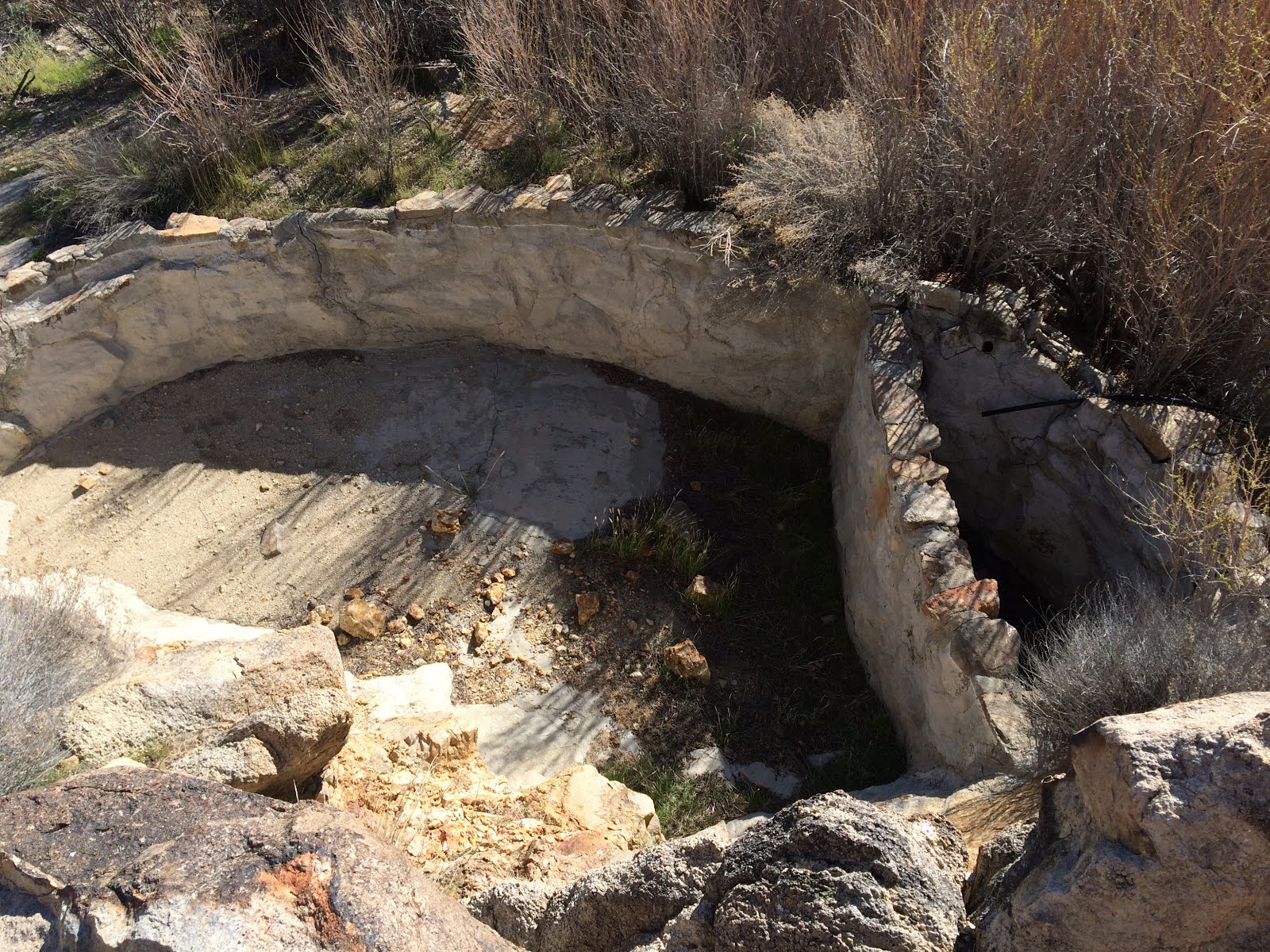
Below is a picture of the ranch's bathroom. On the left is where the toilet was and on the right there is an outline of a small vanity where Manson was found hiding inside when the Sheriff came to arrest the clan.

After leaving Barker Ranch, we took the trail up to the top of Mengel Pass via Goler Wash. Mengel Pass was named after Carl Mengel, a historic prospector from the early 20th century.
Below is a picture of Carl Mengel's monument on top of Mengel Pass. Carl's ashes and prosthetic leg, which he lost in a mining accident, are buried here.
Tradition says you can add a stone to the monument for good luck, which we did.


Here is a view looking down into Death Valley from Mengel pass.

After transversing Mengel Pass we headed to the Geologist Cabin to spend the night but someone had already claimed the cabin for the night, so we found a different desert cabin for the night. Here are a couple of pictures of our campsite.

Evening around the fire.

The cabin had some desert humor.

The next morning we went on a hunt for a hidden hideout or cellar which we did not find but we ended up in the same area where German tourists were stranded in 1996. Their remains were found in 2009. Here is a LINK where you can find more information on the German's and how their remains were found after 13 years. It's an interesting story.
A couple of pictures of the area.


Catch Basin

Throughout the trip we stopped at different desert cabins. Most of the cabins had mining claims associated with them, but most of the mine entrances are sealed. Some of the cabins were run down and falling apart, but others have been adopted by various groups or organizations and are well maintained.
Here are some cabin pictures (not in any particular order).


Some chairs were mounted in concrete on a hill behind one of the cabins with a view of Striped Butte. What a great view!

Another cabin had a old bus. Based on the trail leading to the cabin, it must have taken a lot of work to get the bus to the cabin.


One of the many car chassis scattered around the desert.

Our Saturday night camping site was an old abandoned gypsum mine. Here is a picture with our great view.

On Sunday we visited some more cabins. which are pictured above, and some mines pictured below.

Trails to a couple of different mines.


One of the few open mine shafts. The trail to the shaft is 15 to 30 minutes from the main road and requires a high clearance 4X4. Because of it's remoteness the shaft is left open. The shaft is about 30 feet deep and about 20 feet long.

The mine pictured below had a lot of wooden infrastructure and in it's time must have been very active.


The following pictures are of another interesting mine with a lot of mining equipment and buildings. The background building is the mine residence. The building in the foreground is where they processed the ore.

Inside the residence the floor has collapsed by the couch. The top invoice in the box (in the foreground) is dated 1999. Not very long ago as mines in the area go.

The processing shed had a trough running the length where they processed some of the ore and unlabeled chemicals laying around. Nothing to mess with.

Repurposed ore grinder located above the processing shed.

Tractor located next to mine entrance.

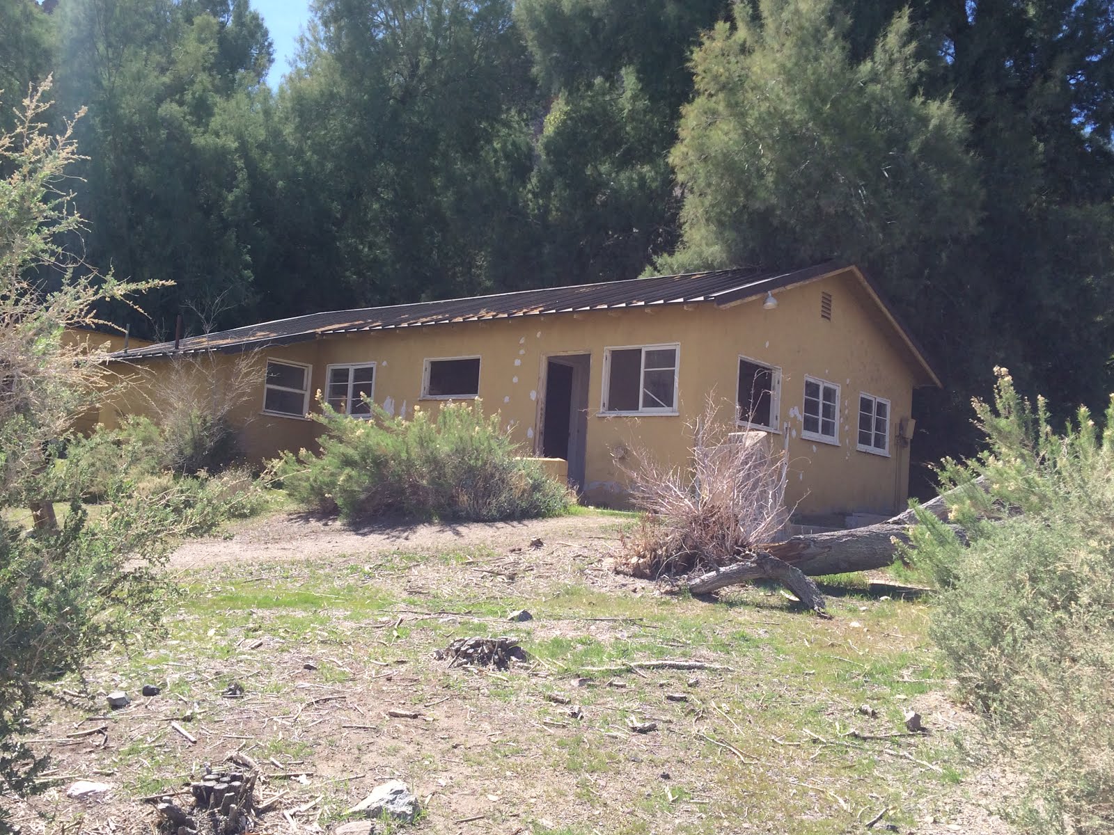
One of our stops was Warm Springs Camp. The real shame is that the Park Service did not use the place as an annex or maintain it after it was donated. It was a beautiful complex, but now the buildings have been vandalized and because of the proximity to water, the walls are covered with wasp's nests. There are at least three separate buildings and a swimming pool.

I've heard stories of people feeding coyote's along the side of Death Valley's roads and here is one. If you stop the coyote will approach the car hoping for a handout. We were not obliging.

And finally, this is a screen shot of our trips track. I hope you enjoyed this report.
