Length of trip May 3rd - 12th: 10 days
Total miles covered (portal to portal) 1200 +
Off-road miles without touching asphalt 400 +
Nearest town Saint George Utah 60 miles
I want to thank our Trail Master Dave for organizing all the logistics that made this trip so successful. I also want to thank the members of our party for all the great food and friendship!
Itinerary included the following locations:
- Our first night was spent enjoying the views and the ever changing colors of the Grand Wash Cliffs.
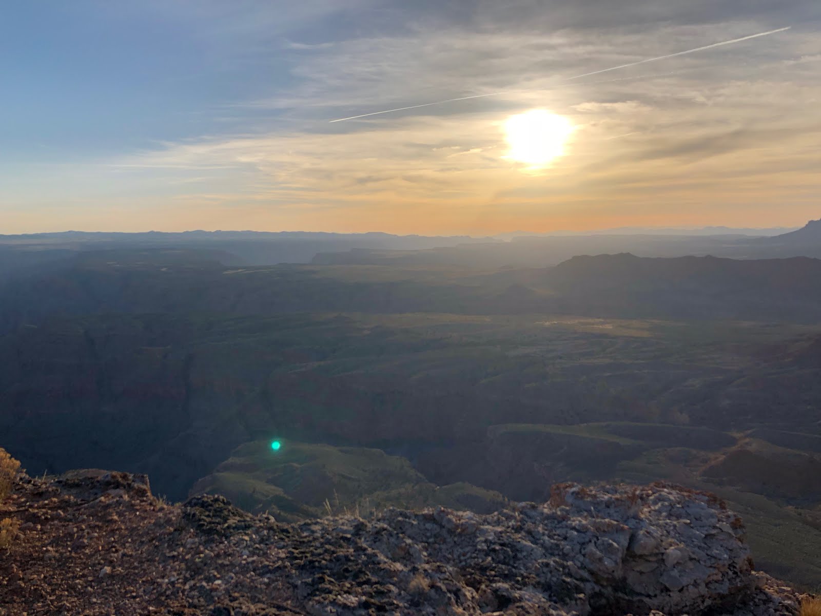
- 2nd and 3rd nights were spent viewing the Grand Canyon from Twin Point Overlook.
- From Twin Point we traveled to Kelly Point. Our route to Kelly Point took us past the Waring Ranch. The next 2 days (4th and 5th) were spent with spectacular views of the Grand Canyon from Kelly Point.
- The 6th night was spent at Whitmore Overlook, where we watched rafters being shuttled by helicopter from the Bar 10 Ranch to and from the Colorado River.
- The 7th night was a real treat. We spent the night at the Bar 10 Ranch. We were treated to a ranch style dinner and breakfast. There were hot showers and we got to sleep in covered wagons. Awesome experience!
- Mount Login was the campsite for our 8th day.
- The 9th day we visited the "Witches Water Pocket" and Toroweap Overlook.
- After Toroweap, we headed home with lasting memories of our "Great Trip".
According to Wikipedia:
"The Grand Canyon Parashant National Monument is a very remote and undeveloped place jointly managed by the National Park Service (NPS) and the Bureau of Land Management (BLM). There are no paved roads into the monument and no visitor services. The 1,048,325-acre (424,242 ha) monument is larger than the state of Rhode Island. The BLM portion of the monument consists of 808,747 acres (327,288 ha).[1] The NPS portion contains 208,453 acres (84,358 ha) of lands that were previously part of Lake Mead National Recreation Area. There are also about 23,205 acres (9,391 ha) of Arizona State Land Department lands and 7,920 acres (3,210 ha) of private lands within the monument boundaries. Grand Canyon-Parashant is not considered a separate unit of the NPS because its NPS area is counted in Lake Mead National Recreation Area.
Elevation ranges from 1,230 feet (370 m) above sea level near Grand Wash Bay at Lake Mead, to 8,029 feet (2,447 m) at Mount Trumbull. The Interagency Information Center is located in the BLM Office in St. George, Utah."
Four primary unpaved roads enter the core of the strip: from Mesquite, Nevada; St. George, Utah; Colorado City, Arizona; and Fredonia, Arizona. All four are dirt/gravel and should not be driven by vehicles with low ground clearance. Motorists should check with the BLM locally before heading into the strip on these roads, and are advised to be prepared – even rangers may not know current conditions, such as snow/ice cover and washouts.
Our route showing speeds

On our way to Grand Wash Cliffs


Grand Wash Cliffs


On our way to Twin Point.


Twin Point


Campsite with shower tent in background.

Dinner

Morning Light on cliffs

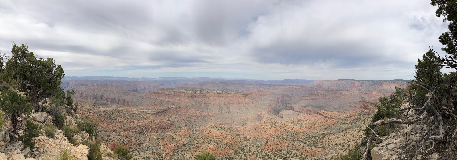
Panorama of Twin Point

Twin Point Sunset

On the way to Kelly Point we passed the Waring Ranch. The cabin had heavy screen wire over doors and windows to protect from vandalism. Inside, you could see some of the original furnishings but it was too dark to take pictures. Horse Valley, the original headquarters of Waring Ranch, was homesteaded in the 1920's by Jonathan Deyo "Slim" Waring.


Trail to Kelly Point. Rocky in places, dusty and sandy in others.


Kelly Point


Panorama of Kelly Point

Breakfast

Campsite Mate...scorpion (On Shovel)

Whitmore Overlook

You can see rafters below (white specs) on the Colorado River


Panorama of of Whitmore Overlook


Bar 10 Ranch, offers ranch style meals and hot showers. For more information on the Bar 10 here is a link.


Our sleeping accommodations


Heliport used to ferry rafters to and from Colorado River.

Mount Trumbull


One of the many ranches throughout the area.


On the way to Mt. Logan.


Lava Flow

Mt. Logan


Our last day was spent at Witches Water Pocket and Toroweap Lookout. The Water Pocket was made famous by John Wesley Powell in the 1870's during his exploration of the Grand Canyon. Powell described the Pocket as a constant water source but it was just a damp spot in the soil this time. The cross was placed here over a hundred years ago to mark the entrance to the Water Pocket. Here is a link to a magazine article on the Witch Pool. Witch Pool
Entrance to Witches Water Pocket.


No visible water, just damp soil, but you can see where an animal had dug down to reach the damp soil and any water that may have seeped into the hole.

Toroweap/Tuweep.
"At 3,000 feet above the Colorado River, the sheer drop from Toroweap Overlook offers a dramatic view. The volcanic cinder cones and lava flows in this ancestral home of the Southern Paiute people make this area unique.
A visit to Tuweep provides an opportunity for an uncrowded, rustic, and remote experience. Access is challenging and demands skill at negotiating difficult roadways. Summer brings monsoonal rain and lighting. Winter includes rain, snow, and freezing temperatures.Be ready for quickly changing conditions.
Services are non-existent: there is no water, gas, food, lodging, or phone service."
Above copied from this National Park website.
The last part of the road into Toroweep.


I highly recommend this area to anyone who likes exploring remote areas and beautiful country with specular views. The Grand Canyon lives up to it's name, "Grand Canyon".
Thank you for viewing my trip report and I hope you enjoyed it.
Phil
2 comments:
Incredibly awesome! I got the feeling that you were going solo. Looks like you have a great group of friends that you went with. How long were you between gas stops? How much fuel is on your FJ?
Our plan was to go the entire trip without gas stops per say. Most of us took an additional 30 gal of gas. The Jeep did not have enough room for that much gas. He was planning on driving 60 miles (one way) from the Bar 10 Ranch to Mesquite to fill up both his Jeep and aux cans. It Turns out the Bar 10 Ranch sells gas so he just filled up there.
Post a Comment